2016
NM7272 : New road for sluice control
taken 8 years ago, near to Ardmolich, Highland, Scotland
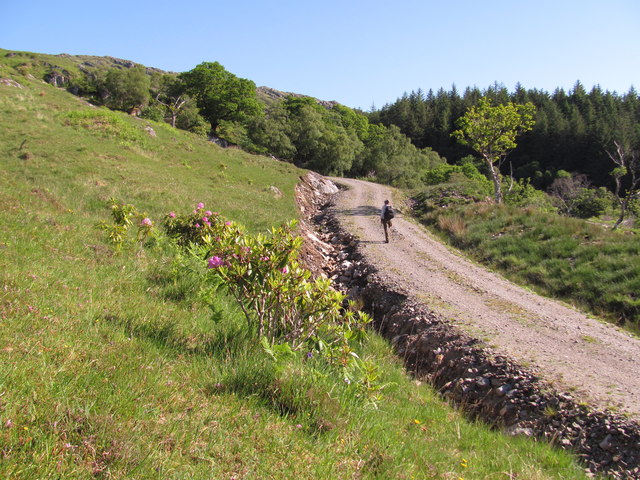
New road for sluice control
This very new road did not show on aerial photo or satellite images. In places the gradient seemed to be about 1 in 3. In the foreground is one of the highest altitude rhododendrons seen on this mountainside.
 Map © Crown Copyright")
TIP: Click the map for more Large scale mapping
- Grid Square
- NM7272, 7 images (more nearby 🔍)
- Photographer
- Graham Cole (more nearby)
- Date Taken
- Wednesday, 1 June, 2016 (more nearby)
- Submitted
- Thursday, 2 June, 2016
- Subject Location
-
OSGB36:
 NM 7271 7267 [10m precision]
WGS84: 56:47.3947N 5:43.3887W - Camera Location
-
OSGB36: NM 7271 7263
- View Direction
- NORTH (about 0 degrees)