2016
SE0706 : The Pennine Way across Wessenden Head Moor, Austonley
taken 8 years ago, 3 km from Holme, Kirklees, England
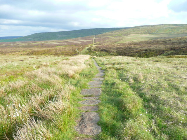
The Pennine Way across Wessenden Head Moor, Austonley
The path is straight, apart from where it crosses cloughs. Thousands of stone flags have been laid - I suppose they must have been carried on a sack cart along flags already laid. It was grass when A. Wainwright walked it before drawing Page 155 of his 'Pennine Way Companion'.
 Map © Crown Copyright")
TIP: Click the map for more Large scale mapping
- Grid Square
- SE0706, 37 images (more nearby 🔍)
- Photographer
- Humphrey Bolton (more nearby)
- Date Taken
- Monday, 30 May, 2016 (more nearby)
- Submitted
- Thursday, 2 June, 2016
- Subject Location
-
OSGB36:
 SE 0766 0697 [10m precision]
WGS84: 53:33.5578N 1:53.1501W - Camera Location
-
OSGB36: SE 0764 0699
- View Direction
- Southeast (about 135 degrees)