2016
SO9197 : Former Pountney Street Methodist Church
taken 8 years ago, near to Blakenhall, Wolverhampton, England
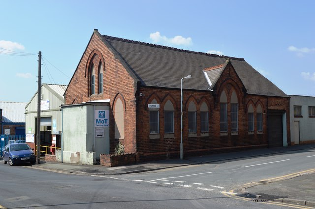
Former Pountney Street Methodist Church
The congregation moved away from the area from the turn of the twentieth century as the area gave way to manufacturing. The church itself closed after the Second World War. It now appears to be used by the neighbouring garage.
 Map © Crown Copyright")
TIP: Click the map for more Large scale mapping
- Grid Square
- SO9197, 427 images (more nearby 🔍)
- Photographer
- John M (more nearby)
- Date Taken
- Thursday, 12 May, 2016 (more nearby)
- Submitted
- Saturday, 4 June, 2016
- Subject Location
-
OSGB36:
 SO 9131 9780 [10m precision]
WGS84: 52:34.6766N 2:7.7802W - Camera Location
-
OSGB36: SO 9132 9780
- View Direction
- North-northwest (about 337 degrees)