2016
NT1961 : Crooked Rig and Carnethy
taken 8 years ago, near to Silverburn, Midlothian, Scotland
This is 1 of 2 images, with title starting with Crooked in this square
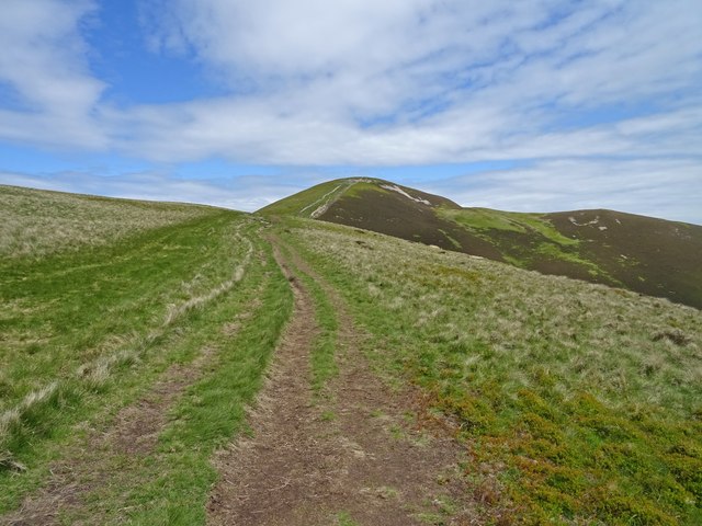
Crooked Rig and Carnethy
Ascending the lower part of the path from the coll between Carnethy and Scald Law on an early summers day crossing the shoulder of Crooked Rig.
 Map © Crown Copyright")
TIP: Click the map for more Large scale mapping
- Grid Square
- NT1961, 71 images (more nearby 🔍)
- Photographer
- Adam Ward (more nearby)
- Date Taken
- Thursday, 2 June, 2016 (more nearby)
- Submitted
- Tuesday, 7 June, 2016
- Subject Location
-
OSGB36:
 NT 1982 6172 [10m precision]
WGS84: 55:50.5204N 3:16.9172W - Camera Location
-
OSGB36: NT 1958 6158
- View Direction
- East-northeast (about 67 degrees)