2013
NN3269 : Loch Treig
taken 11 years ago, near to Sròn Nan Gall [other Features], Highland, Great Britain
This is 1 of 7 images, with title Loch Treig in this square
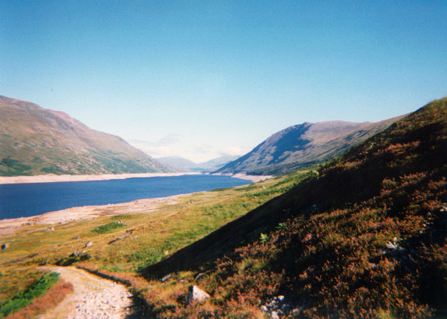
Loch Treig
The loch seen from the south. The hills on either side of the loch are the Munros of Stob Coire Sgriodain (right) and Stob a' Choire Mheadoin (left). The West Highland railway line runs along the east side of the loch.
For an interesting historical note on Loch Treig read this: Link
For an interesting historical note on Loch Treig read this: Link
 Map © Crown Copyright")
TIP: Click the map for more Large scale mapping
- Grid Square
- NN3269, 12 images (more nearby 🔍)
- Photographer
- Bill Kasman (more nearby)
- Date Taken
- Wednesday, 25 September, 2013 (more nearby)
- Submitted
- Sunday, 12 June, 2016
- Subject Location
-
OSGB36:
 NN 327 699 [100m precision]
WGS84: 56:47.4733N 4:44.3992W - Camera Location
-
OSGB36: NN 329 685
- View Direction
- NORTH (about 0 degrees)