2016
SX9498 : Sandy Lane level crossing
taken 8 years ago, near to Stoke Canon, Devon, England
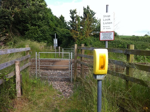
Sandy Lane level crossing
Level crossing on the path from the A396 at Rewe to Burrow's Cross. The path is remarkably narrow, confined between long-established Devon banks, and would surely never have accommodated carts, so must be a bridleway. It is however recorded as an unclassified road. The level crossing is now equipped with gates which would pass a horse rider (although there was a time when there were kissing gates here fit only for pedestrians). The sign enjoins users to phone for advice on crossing the railway, presumably because of the poor visibility to the north.
 Map © Crown Copyright")
TIP: Click the map for more Large scale mapping
- Grid Square
- SX9498, 48 images (more nearby 🔍)
- Photographer
- Hugh Craddock (more nearby)
- Date Taken
- Friday, 17 June, 2016 (more nearby)
- Submitted
- Sunday, 19 June, 2016
- Subject Location
-
OSGB36:
 SX 9417 9897 [10m precision]
WGS84: 50:46.8371N 3:30.1495W - Camera Location
-
OSGB36: SX 9415 9897
- View Direction
- East-southeast (about 112 degrees)