2016
NF7761 : Storm beach at Ceardach Ruadh
taken 8 years ago, near to Teanna Mhachair, North Uist & Berneray, Na h-Eileanan an Iar, Scotland
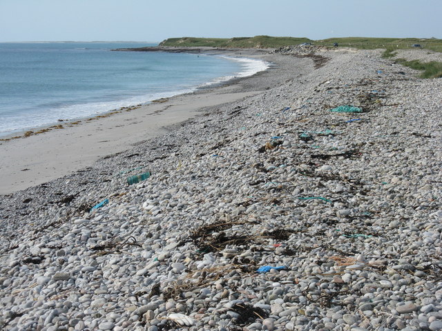
Storm beach at Ceardach Ruadh
The western shore of Baleshare/Baile Sear, facing the Atlantic Ocean. Note the debris from, mostly I suspect, the fishing industry.
 Map © Crown Copyright")
TIP: Click the map for more Large scale mapping
- Grid Square
- NF7761, 28 images (more nearby 🔍)
- Photographer
- M J Richardson (more nearby)
- Date Taken
- Saturday, 4 June, 2016 (more nearby)
- Submitted
- Wednesday, 6 July, 2016
- Subject Location
-
OSGB36:
 NF 778 613 [100m precision]
WGS84: 57:31.6511N 7:23.1062W - Camera Location
-
OSGB36: NF 779 613
- View Direction
- Northwest (about 315 degrees)