2007
SK6197 : Radburn Road
taken 17 years ago, near to New Rossington, Doncaster, England
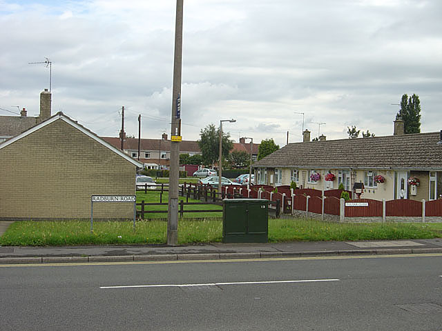
Radburn Road
The layout of this part of the development suggests that the name was given in recognition of the principles laid down in Radburn, New Jersey to create residential areas with segregated vehicle and pedestrian routes. Radburn is the spine route through the development. In practice, the estate design really only pays lip service to the principle, as there are many homes facing onto roads
 Map © Crown Copyright")
TIP: Click the map for more Large scale mapping
- Grid Square
- SK6197, 20 images (more nearby 🔍)
- Photographer
- Alan Murray-Rust (more nearby)
- Date Taken
- Sunday, 22 July, 2007 (more nearby)
- Submitted
- Monday, 23 July, 2007
- Subject Location
-
OSGB36:
 SK 615 974 [100m precision]
WGS84: 53:28.1954N 1:4.4182W - Camera Location
-
OSGB36: SK 615 973
- View Direction
- North-northeast (about 22 degrees)