2016
NN2060 : Lower Penstock
taken 8 years ago, 3 km from Kinlochleven, Highland, Scotland
This is 1 of 2 images, with title Lower Penstock in this square
Lower Penstock
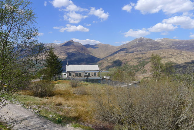
The Lower Penstock Valve House. At this point the aqueduct from the Blackwater Reservoir enters a basin, and the penstock valves control the amount of water flowing into the six pipelines leading down to the hydro-electric station at Kinlochleven.
 Map © Crown Copyright")
TIP: Click the map for more Large scale mapping
- Grid Square
- NN2060, 33 images (more nearby 🔍)
- Photographer
- Tim Heaton (more nearby)
- Date Taken
- Monday, 9 May, 2016 (more nearby)
- Submitted
- Thursday, 14 July, 2016
- Subject Location
-
OSGB36:
 NN 2018 6045 [10m precision]
WGS84: 56:42.0623N 4:56.3180W - Camera Location
-
OSGB36: NN 2021 6036
- View Direction
- North-northwest (about 337 degrees)