SJ8498 : Market Street from Piccadilly
taken 8 years ago, near to Manchester, England
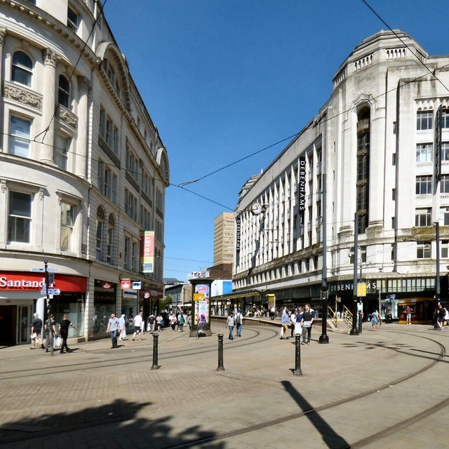
Debenhams was founded in London in 1778 by Thomas Clark under the name 'Flint and Clark'; there were a number of partner and name changes before the store became 'Debenhams Limited' in 1905.
The large department store was best known for its clothing, cosmetics and home ware.
In 2009 Debenhams had over 153 stores in the UK, with more due to open.
All stores closed for ever in 2021.
Market Street Metrolink station is a tram stop on the Metrolink light rail system. It is located on Market Street, in Manchester city centre. It opened on 27 April 1992 as part of Phase 1 of Metrolink's expansion.
Originally the stop in Market Street handled trams to Bury Interchange only, with High Street Metrolink station handling trams from Bury only. When Market Street was pedestrianised, High Street stop was closed, and Market Street was reconfigured to handle trams in both directions. This stop opened on 10 August 1998.
 Map © Crown Copyright")
- Grid Square
- SJ8498, 3904 images (more nearby 🔍)
- Photographer
- Gerald England (more nearby)
- Date Taken
- Tuesday, 19 July, 2016 (more nearby)
- Submitted
- Thursday, 21 July, 2016
- Subject Location
-
OSGB36:
 SJ 8428 9836 [10m precision]
WGS84: 53:28.9034N 2:14.3008W - Camera Location
-
OSGB36: SJ 8432 9832
- View Direction
- Northwest (about 315 degrees)