1999
NH0848 : View south east from Sgùrr nan Ceannaichean
taken 25 years ago, near to Sgùrr Nan Ceannaichean [hill or Mountain], Highland, Great Britain
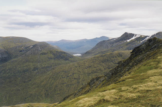
View south east from Sgùrr nan Ceannaichean
The summit is on the extreme right of the picture. The pointed peak behind is Bidean an Eoin Deirg, with Loch Mhuilich in the middle, Carn nam Fiaclan on the left and Sgùrr na Lapaich in the distance.
At one point this mountain was classified as a Munro (mountains over 914.4 metres) but was demoted in 2009 after a resurvey claimed the height was 913.43 metres. Such fussy attention to minute detail belies the fact that this is a fine mountain and well worth climbing.
At one point this mountain was classified as a Munro (mountains over 914.4 metres) but was demoted in 2009 after a resurvey claimed the height was 913.43 metres. Such fussy attention to minute detail belies the fact that this is a fine mountain and well worth climbing.
 Map © Crown Copyright")
TIP: Click the map for more Large scale mapping
- Grid Square
- NH0848, 14 images (more nearby 🔍)
- Photographer
- Nigel Brown (more nearby)
- Date Taken
- Tuesday, 1 June, 1999 (more nearby)
- Submitted
- Wednesday, 25 July, 2007
- Subject Location
-
OSGB36:
 NH 088 482 [100m precision]
WGS84: 57:29.0266N 5:11.4510W - Camera Location
-
OSGB36: NH 087 483
- View Direction
- Southeast (about 135 degrees)