2016
NZ3845 : Interpretation board, South Hetton
taken 8 years ago, near to South Hetton, County Durham, England
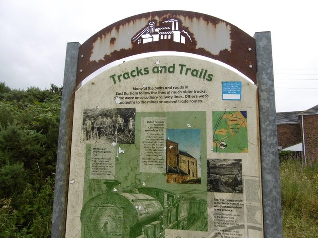
Interpretation board, South Hetton
A survivor, most of these boards have been rendered illegible by idiots with spray cans. This is on an old wagonway, part of the South Hetton Railway or Bradyll's Line which connected South Hetton, Haswell, Shotton and Murton Collieries with Seaham.
 Map © Crown Copyright")
TIP: Click the map for more Large scale mapping
- Grid Square
- NZ3845, 16 images (more nearby 🔍)
- Photographer
- Richard Webb (more nearby)
- Date Taken
- Tuesday, 9 August, 2016 (more nearby)
- Submitted
- Monday, 15 August, 2016
- Subject Location
-
OSGB36:
 NZ 3822 4509 [10m precision]
WGS84: 54:47.9544N 1:24.4213W - Camera Location
-
OSGB36: NZ 3823 4509
- View Direction
- West-northwest (about 292 degrees)