2016
TQ4363 : Footpath and bridleway into the woods near Downe
taken 8 years ago, near to Farnborough, Bromley, England
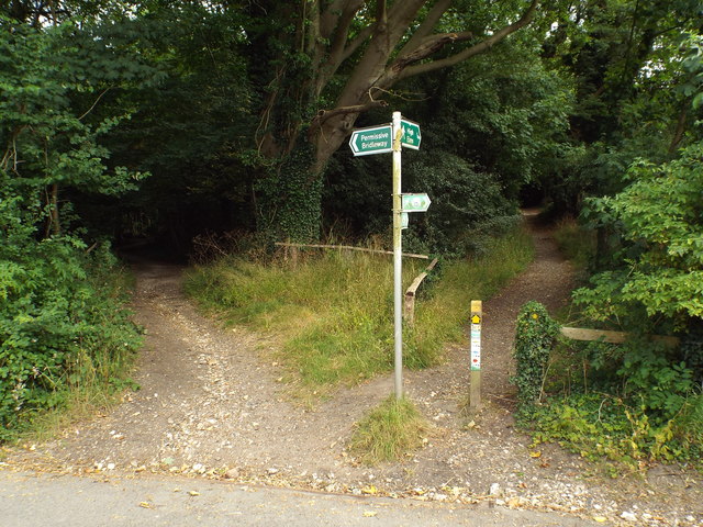
Footpath and bridleway into the woods near Downe
The path to the left is a permissive bridleway while the path to the right forms part of the London Loop.
London Outer Orbital Path (LOOP)
Starting at the Thames at Erith and finishing on the opposite north bank at Coldharbour, the Loop (London Outer Orbital Path) is 150 miles long, passing through numerous woods, commons and parks and on waterside paths alongside the Grand Union Canal and London rivers such as the Colne, Crane, Cray, Darent and Ingrebourne.
 Map © Crown Copyright")
TIP: Click the map for more Large scale mapping
- Grid Square
- TQ4363, 107 images (more nearby 🔍)
- Photographer
- Malc McDonald (more nearby)
- Date Taken
- Sunday, 31 July, 2016 (more nearby)
- Submitted
- Monday, 15 August, 2016
- Subject Location
-
OSGB36:
 TQ 4383 6316 [10m precision]
WGS84: 51:20.9594N 0:3.8367E - Camera Location
-
OSGB36: TQ 4382 6317
- View Direction
- Southeast (about 135 degrees)