2016
TR5373 : Wind turbines, Thanet Wind Farm
taken 8 years ago, 15 km ENE of Broadstairs, Kent, England
This is 1 of 2 images, with title Wind turbines, Thanet Wind Farm in this square
Wind turbines, Thanet Wind Farm
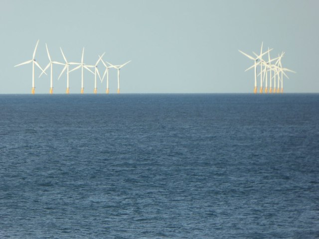
Thanet Wind Farm viewed from Joss Bay. The wind farm is 12km off Foreness Point and covers an area of 13.5 square miles (35 km2), which includes numerous OS grid squares. The turbines spaced at 500 metres (1,600 ft) with 800 metres (2,600 ft) between the rows. The wind farm has operated since 2010 and consists of 100 Vestas wind turbines. When it was built it was the largest off-shore wind farm in the world.
 Map © Crown Copyright")
TIP: Click the map for more Large scale mapping
- Grid Square
- TR5373, 4 images (more nearby 🔍)
- Photographer
- Philip Halling (more nearby)
- Date Taken
- Sunday, 21 August, 2016 (more nearby)
- Submitted
- Sunday, 28 August, 2016
- Subject Location
-
OSGB36:
 TR 5339 7351 [10m precision]
WGS84: 51:24.2381N 1:38.5127E - Camera Location
-
OSGB36: TR 3991 7005
- View Direction
- East-northeast (about 67 degrees)