2016
SY6878 : Stone Pier, Weymouth
taken 8 years ago, near to Weymouth, Dorset, England
This is 1 of 3 images, with title starting with Stone Pier in this square
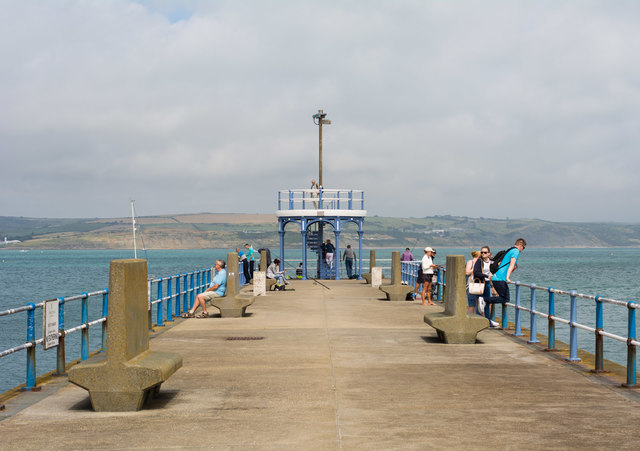
Stone Pier, Weymouth
The breakwater on the south side of the harbour. The structure at the end is a raised observation platform; a similar structure can be found at Herne Bay TR1768 : The end of Neptune's Arm, Herne Bay.
 Map © Crown Copyright")
TIP: Click the map for more Large scale mapping
- Grid Square
- SY6878, 1275 images (more nearby 🔍)
- Photographer
- Oliver Mills (more nearby)
- Date Taken
- Monday, 22 August, 2016 (more nearby)
- Submitted
- Monday, 29 August, 2016
- Subject Location
-
OSGB36:
 SY 6885 7896 [10m precision]
WGS84: 50:36.5710N 2:26.4953W - Camera Location
-
OSGB36: SY 6880 7891
- View Direction
- Northeast (about 45 degrees)