2016
NB0637 : Peat hags
taken 8 years ago, near to Aird Uig, Isle of Lewis And Harris, Na h-Eileanan an Iar, Scotland
This is 1 of 2 images, with title Peat hags in this square
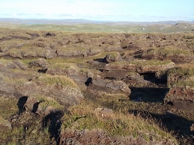
Peat hags
Stay up slope as much as you can to avoid walking through this "moonscape". A line from the end of Loch Deireadh Banaig to Rubha Mor should avoid the worst but not all, tough walking!
 Map © Crown Copyright")
TIP: Click the map for more Large scale mapping
- Grid Square
- NB0637, 2 images (more nearby 🔍)
- Photographer
- Simon Bonney (more nearby)
- Date Taken
- Sunday, 28 August, 2016 (more nearby)
- Submitted
- Tuesday, 6 September, 2016
- Subject Location
-
OSGB36:
 NB 0668 3748 [10m precision]
WGS84: 58:13.6819N 6:59.9101W - Camera Location
-
OSGB36: NB 0656 3748
- View Direction
- EAST (about 90 degrees)