2016
SP8966 : A45 Bridge over River Nene at little Irchester
taken 8 years ago, near to Wellingborough, North Northamptonshire, England
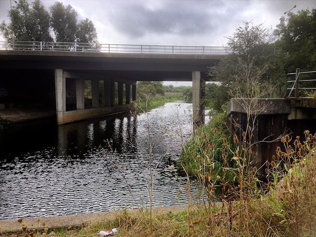
A45 Bridge over River Nene at little Irchester
The A45 is a major road which runs for almost 76 miles from Bordesley, Birmingham to Thrapston where it meets the A14. Prior to the construction of the M6 motorway it was the main route from the Midlands to Ipswich and Felixstowe. When the A1-M1 link road section of the current A14 opened in 1994 most of the A45 to the east of Cambridge was re-designated as the A14 and some sections to the west were downgraded to B-roads. The current route of the A45 and runs for less than half its original length, although it still provides an important link from Birmingham, Coventry, and Leamington to Northampton and the M1, avoiding the M6.
Link SABRE
SABRE
Link Wikipedia
See other images of The A45
Link
Link
See other images of The A45
 Map © Crown Copyright")
TIP: Click the map for more Large scale mapping
- Grid Square
- SP8966, 19 images (more nearby 🔍)
- Photographer
- David Dixon (more nearby)
- Date Taken
- Wednesday, 7 September, 2016 (more nearby)
- Submitted
- Monday, 12 September, 2016
- Subject Location
-
OSGB36:
 SP 899 663 [100m precision]
WGS84: 52:17.2974N 0:40.9346W - Camera Location
-
OSGB36: SP 899 664
- View Direction
- SOUTH (about 180 degrees)