2016
SJ2641 : Gate Road, Froncysyllte
taken 8 years ago, near to Froncysyllte, Wrexham/Wrecsam, Wales
This is 1 of 3 images, with title starting with Gate Road in this square
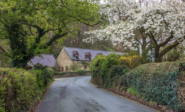
Gate Road, Froncysyllte
On the lane below the Pontcysyllte Aqueduct, the dwellings in the picture are converted farm buildings and is known locally as 'Pigsty Corner'.
 Map © Crown Copyright")
TIP: Click the map for more Large scale mapping
- Grid Square
- SJ2641, 125 images (more nearby 🔍)
- Photographer
- Geraint Roberts (more nearby)
- Date Taken
- Monday, 25 April, 2016 (more nearby)
- Submitted
- Tuesday, 13 September, 2016
- Subject Location
-
OSGB36:
 SJ 2695 4173 [10m precision]
WGS84: 52:58.0759N 3:5.3480W - Camera Location
-
OSGB36: SJ 2688 4181
- View Direction
- Southeast (about 135 degrees)