2006
SD4761 : Rosemary Lane from Stonewell Lancaster
taken 18 years ago, near to Lancaster, Lancashire, England
This is 1 of 2 images, with title starting with Rosemary in this square
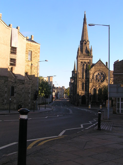
Rosemary Lane from Stonewell Lancaster
Main building, on the right, is the Fleece and Friary. The building to the left is a multi-storey car park. Taken early in the morning with no traffic!
 Map © Crown Copyright")
TIP: Click the map for more Large scale mapping
- Grid Square
- SD4761, 1203 images (more nearby 🔍)
- Photographer
- Robin Madge (more nearby)
- Date Taken
- Tuesday, 30 May, 2006 (more nearby)
- Submitted
- Tuesday, 31 July, 2007
- Subject Location
-
OSGB36:
 SD 478 618 [100m precision]
WGS84: 54:2.9758N 2:47.9078W - Camera Location
-
OSGB36: SD 478 617
- View Direction
- North-northwest (about 337 degrees)