2016
ST3093 : Entrance road to the former Llantarnam Comprehensive School, Cwmbran
taken 8 years ago, near to Croes-y-Mwyalch, Torfaen/Tor-Faen, Wales
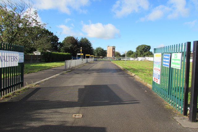
Entrance road to the former Llantarnam Comprehensive School, Cwmbran
Now a building site (authorised access only) viewed from Llantarnam Road in late September 2016. The school was placed on special measures after the publication of an unsatisfactory Estyn inspection report in November 2012. The school closed down in July 2015, at the end of the 2014-2015 academic year. The school merged with Fairwater High School on the Fairwater site to create Cwmbran High School which opened in September 2015.
The site of the former Llantarnam Comprehensive School will be used for new housing developments and a new school, Llantarnam Primary School.
The site of the former Llantarnam Comprehensive School will be used for new housing developments and a new school, Llantarnam Primary School.
 Map © Crown Copyright")
TIP: Click the map for more Large scale mapping
- Grid Square
- ST3093, 370 images (more nearby 🔍)
- Photographer
- Jaggery (more nearby)
- Date Taken
- Thursday, 22 September, 2016 (more nearby)
- Submitted
- Thursday, 22 September, 2016
- Subject Location
-
OSGB36:
 ST 3036 9353 [10m precision]
WGS84: 51:38.1748N 3:0.4594W - Camera Location
-
OSGB36: ST 3044 9361
- View Direction
- Southwest (about 225 degrees)