NS3976 : Turkey Oak beside footpath
taken 8 years ago, near to Renton, West Dunbartonshire, Scotland
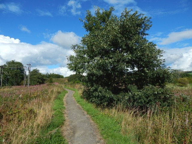
Turkey Oak (Quercus cerris) is native to south and east Europe, but has been planted widely in the north and west over the last four centuries. Certain kinds of gall wasp have as host plants, in alternate generations, Turkey Oak and another oak species; that is to say, every second generation needs Turkey Oak to be present as a host plant, while the intervening generations depend on a different oak species.
For a specific example, see NS3878 : Oak marble galls, caused by the wasp Andricus kollari. Every second generation of this wasp species forms marble galls on Pedunculate or Sessile Oak, while the intervening generations emerge from bud galls on Turkey Oak. The wasp is therefore found only in areas where both types of oak are present.
This part of the path is between the NS3976 : SUDS pond at Lomondgate (behind and to the right of the photographer's position), and the NS3976 : Pedestrian underpass beneath dual carriageway, which is not far ahead.
This description covers a subset of West Dumbartonshire's core paths (4953 inclusive and 157) that, when taken together, make up a continuous path (49 + 50 + 52 + 53) along or near the eastern bank of the River Leven ( Link ), beginning at the Lion's Gate at Kilmalid, and ending at Dumbarton Rock(*). Two shorter paths (51 and 157) branch off from the riverside path. Others paths branch off from it near the SUDS pond at Lomondgate ( Link ); these are also included here, although they are not core paths.
(*) Note that, as of mid-2018, core path 53 stops at the east end of Riverside Lane, but it is intended that it eventually be extended to become a riverside walkway to Dumbarton Rock.
See Link(PDF, 1.3MB, at the West Dunbartonshire Council website) for a visual index to all of these paths. Summary descriptions (where "BMIE" = Broadmeadow Industrial Estate and "CP" = Core Path):
CP 49 (741m): Beside the Murroch Burn; from the Lion's Gate to the Blue Bridge.
CP 50 (1019m): Heads south (beside a golf course) from the Blue Bridge to NW corner of BMIE.
CP 51 (440m): Branches off eastwards from CP 50; leads to Overburn Avenue.
CP 52 (849m): Heads south from NW corner of BMIE to Dumbarton Bridge.
CP 157 (84m): A short path branching off east from CP 52; leads to Poplar Road.
CP 53 (476m+): From Dumbarton Bridge to Riverside Lane (and, later, to Dumbarton Rock).
 Map © Crown Copyright")
- Grid Square
- NS3976, 200 images (more nearby 🔍)
- Photographer
- Lairich Rig (more nearby)
- Date Taken
- Sunday, 4 September, 2016 (more nearby)
- Submitted
- Saturday, 24 September, 2016
- Subject Location
-
OSGB36:
 NS 3948 7690 [10m precision]
WGS84: 55:57.4929N 4:34.3688W - Camera Location
-
OSGB36: NS 3947 7688
- View Direction
- North-northeast (about 22 degrees)