2016
SK8610 : Site of former entrance to buildings in field behind hedge beside Ashwell Road
taken 8 years ago, near to Burley, Rutland, England
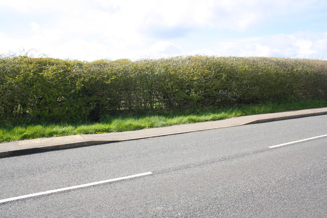
Site of former entrance to buildings in field behind hedge beside Ashwell Road
The buildings shown on the 1975 1:2500 Map appear to have been demolished. The dropped kerb is a sign that there used to be an entrance here.
 Map © Crown Copyright")
TIP: Click the map for more Large scale mapping
- Grid Square
- SK8610, 14 images (more nearby 🔍)
- Photographer
- Roger Templeman (more nearby)
- Date Taken
- Friday, 29 April, 2016 (more nearby)
- Submitted
- Tuesday, 27 September, 2016
- Subject Location
-
OSGB36:
 SK 8658 1054 [10m precision]
WGS84: 52:41.1386N 0:43.2370W - Camera Location
-
OSGB36: SK 8660 1053
- View Direction
- Northwest (about 315 degrees)