2016
NC8413 : Erosion Scar at Allt nan Nathraichean near Gordonbush, Sutherland
taken 8 years ago, 4 km NE of Balnacoil, Highland, Scotland
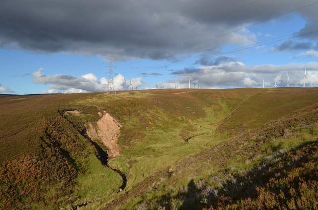
Erosion Scar at Allt nan Nathraichean near Gordonbush, Sutherland
An erosion scar in the steep sided valley of the Allt nan Nathraichean (watercourse) below Gordonbush windfarm in east Sutherland, Scotland.
 Map © Crown Copyright")
TIP: Click the map for more Large scale mapping
- Grid Square
- NC8413 (more nearby 🔍)
- Photographer
- Andrew Tryon (more nearby)
- Date Taken
- Saturday, 1 October, 2016 (more nearby)
- Submitted
- Saturday, 8 October, 2016
- Subject Location
-
OSGB36:
 NC 8407 1395 [10m precision]
WGS84: 58:5.9597N 3:58.1119W - Camera Location
-
OSGB36: NC 8401 1389
- View Direction
- Northeast (about 45 degrees)