2016
TQ1034 : Hermongers from the air
taken 8 years ago, near to Rudgwick, West Sussex, England
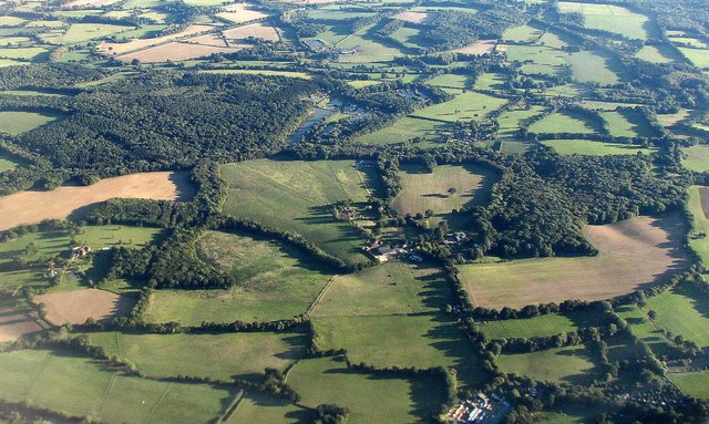
Hermongers from the air
Showing countryside east of Rudgwick. Beyond Hermongers and its farm are fishing lakes near Hyes. To the left are Roman Woods. On the right of Hermongers is Godley's Copse.
Running across the lower part of the image, past Hermongers and Godley's Copse, is the Sussex Border Path.
Running across the lower part of the image, past Hermongers and Godley's Copse, is the Sussex Border Path.
 Map © Crown Copyright")
TIP: Click the map for more Large scale mapping
- Grid Square
- TQ1034, 19 images (more nearby 🔍)
- Photographer
- Derek Harper (more nearby)
- Date Taken
- Monday, 3 October, 2016 (more nearby)
- Submitted
- Wednesday, 12 October, 2016
- Subject Location
-
OSGB36:
 TQ 101 343 [100m precision]
WGS84: 51:5.8468N 0:25.7419W - Camera Location
-
OSGB36: TQ 096 358
- View Direction
- South-southeast (about 157 degrees)