2016
ST5378 : Motorway slip roads near Lawrence Weston
taken 7 years ago, near to Shirehampton, Bristol, England
This is 1 of 2 images, with title Motorway slip roads near Lawrence Weston in this square
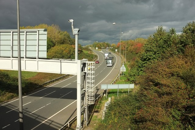
Motorway slip roads near Lawrence Weston
Two lane merge; the right-hand one is for southbound traffic leaving the M5 at junction 18a; the left-hand is the southbound M49, with traffic either joining the M5 or heading into Avonmouth and Bristol. Seen from the bridge carrying King's Weston Lane.
 Map © Crown Copyright")
TIP: Click the map for more Large scale mapping
- Grid Square
- ST5378, 50 images (more nearby 🔍)
- Photographer
- Derek Harper (more nearby)
- Date Taken
- Wednesday, 19 October, 2016 (more nearby)
- Submitted
- Tuesday, 25 October, 2016
- Subject Location
-
OSGB36:
 ST 537 783 [100m precision]
WGS84: 51:30.1037N 2:40.1055W - Camera Location
-
OSGB36: ST 5369 7820
- View Direction
- North-northeast (about 22 degrees)