2016
NS4661 : Stanely Reservoir and Castle
taken 8 years ago, near to Glenburn, Renfrewshire, Scotland
This is 1 of 4 images, with title Stanely Reservoir and Castle in this square
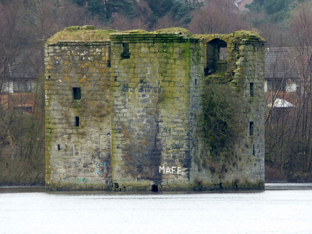
Stanely Reservoir and Castle
The ruined early 15th Century castle is at the west end of the reservoir and is surrounded by water which covers the ground floor.
Stanely Reservoir and Castle
The reservoir was opened in 1838 to provide water to the people and mills of Paisley. The ground floor of the derelict Stanely Castle was flooded as the reservoir level was increased over a period of years.
 Map © Crown Copyright")
TIP: Click the map for more Large scale mapping
- Grid Square
- NS4661, 85 images (more nearby 🔍)
- Photographer
- Thomas Nugent (more nearby)
- Date Taken
- Monday, 29 February, 2016 (more nearby)
- Submitted
- Monday, 31 October, 2016
- Subject Location
-
OSGB36:
 NS 4636 6163 [10m precision]
WGS84: 55:49.4036N 4:27.2432W - Camera Location
-
OSGB36: NS 4685 6163
- View Direction
- WEST (about 270 degrees)