2016
NS4375 : Path near Greenland Farm
taken 7 years ago, near to Milton, West Dunbartonshire, Scotland
This is 1 of 10 images, with title Path near Greenland Farm in this square
Path near Greenland Farm
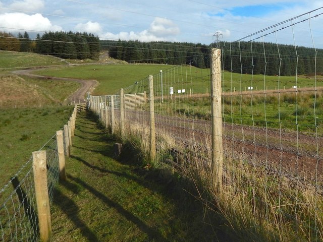
This is a view towards the upper end of the fenced-in part of the route, shown in the opposite direction in NS4375 : Path near Greenland Farm, and, from beyond the gate that marks that end of the path, in NS4375 : Path near Greenland Farm.
Path near Greenland Farm
The area near Greenland Farm had been the subject of protracted negotiations to secure public land access, as specified by the Land Reform (Scotland) Act 2003. The situation was resolved by the creation of a path, bounded by two fences, for the use of pedestrians and cyclists; it now forms part of the Crags Circular Path, a much longer route.
 Map © Crown Copyright")
TIP: Click the map for more Large scale mapping
- Grid Square
- NS4375, 60 images (more nearby 🔍)
- Photographer
- Lairich Rig (more nearby)
- Date Taken
- Friday, 21 October, 2016 (more nearby)
- Submitted
- Wednesday, 2 November, 2016
- Subject Location
-
OSGB36:
 NS 4372 7541 [10m precision]
WGS84: 55:56.7743N 4:30.2464W - Camera Location
-
OSGB36: NS 4372 7540
- View Direction
- North-northeast (about 22 degrees)