SP2097 : Curdworth Bottom Lock
taken 7 years ago, near to Kingsbury, Warwickshire, England
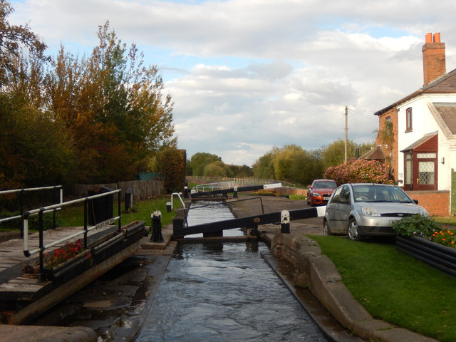
The Birmingham and Fazeley Canal's original purpose was to provide a link between Birmingham and the south east of England, by way of the Coventry Canal and the Oxford Canal. John Smeaton was the engineer, and the canal was completed in 1789. The canal now runs from the BCN Main Line at Deep Cuttings Junction*, Birmingham to the Coventry Canal at Fazeley Junction, just outside Tamworth. The length is 15 miles (24 km), and it includes 38 locks. There is also a short branch to Digbeth, Birmingham. A further extension was built along the planned course of the Coventry Canal as far as Whittington. (Information from Wikipedia Link
)
* Note: The two hundred metres between Deep Cuttings Junction and Farmer's Bridge Top Lock (by Cambrian Wharf) was originally part of the Birmingham Canal Navigations (Newhall Branch).
 Map © Crown Copyright")
- Grid Square
- SP2097, 49 images (more nearby 🔍)
- Photographer
- Stephen McKay (more nearby)
- Date Taken
- Thursday, 20 October, 2016 (more nearby)
- Submitted
- Sunday, 6 November, 2016
- Subject Location
-
OSGB36:
 SP 2018 9730 [10m precision]
WGS84: 52:34.3890N 1:42.2202W - Camera Location
-
OSGB36: SP 2018 9727
- View Direction
- NORTH (about 0 degrees)