2016
SJ8846 : Hanley Park: boathouse
taken 7 years ago, near to Stoke-on-Trent, England
This is 1 of 2 images, with title Hanley Park: boathouse in this square
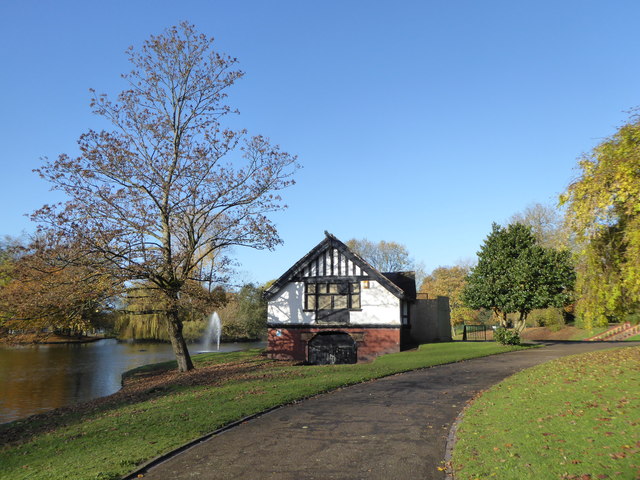
Hanley Park: boathouse
Hanley Park was opened in 1897, and occupies 63 acres of former waste land between Shelton and Hanley. Development of the park and lake was under the guidance of Thomas H Mawson of Windermere (he also designed Burslem Park). The Pavilion, completed in 1896 was designed by Dan Gibson. The Bandstand was the beneficiary of Mr George Howson a local pottery owner.
The Caldon Canal flows east-west through the middle of the Park.
In recent years several of the buildings have fallen into disrepair. In June 2015, it was announced that a £4.5 million Heritage Lottery Fund grant had been secured, which would allow for the restoration of the pavilion, boathouse, canal bridges, lake and fountains.
Hanley Park Run is held every Saturday at 9 a.m. Entrants may be of all ages shapes and sizes, and may complete the 5 km route at their own pace.
Hanley Park (Wikipedia): Link
Hanley Park (potteries.org): Link
Hanley Park Run: Link
See other images of Hanley Park
 Map © Crown Copyright")
TIP: Click the map for more Large scale mapping
- Grid Square
- SJ8846, 193 images (more nearby 🔍)
- Photographer
- Jonathan Hutchins (more nearby)
- Date Taken
- Saturday, 5 November, 2016 (more nearby)
- Submitted
- Sunday, 6 November, 2016
- Subject Location
-
OSGB36:
 SJ 8827 4621 [10m precision]
WGS84: 53:0.7839N 2:10.5770W - Camera Location
-
OSGB36: SJ 88299 46214
- View Direction
- WEST (about 270 degrees)