2016
TR2955 : Looking northeast along an unnamed road
taken 7 years ago, near to Woodnesborough, Kent, England
This is 1 of 2 images, with title Looking northeast along an unnamed road in this square
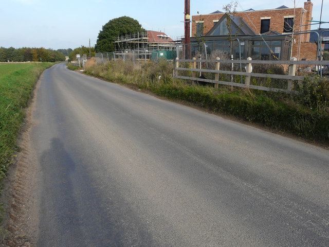
Looking northeast along an unnamed road
That runs past the former Hammill Brick Works redevelopment. The house on the right can also be seen in another image of the TR2955 : Redevelopment of the former Hammill Brick Works.
Planning permission was granted by Dover District Council under application number DOV/12/00450, for (A) Full application for change of use and conversion of two engine sheds to six live/work units and (B) Outline application for the erection of nineteen dwellings of B1(c) accommodation, construction of vehicular access, associated car parking and landscaping (existing buildings/structures to be demolished).
The development of the site, which has been named Hammill Park, is being managed by Quinn Estates
Link (Archive Link )
Planning permission was granted by Dover District Council under application number DOV/12/00450, for (A) Full application for change of use and conversion of two engine sheds to six live/work units and (B) Outline application for the erection of nineteen dwellings of B1(c) accommodation, construction of vehicular access, associated car parking and landscaping (existing buildings/structures to be demolished).
The development of the site, which has been named Hammill Park, is being managed by Quinn Estates
Link
 Map © Crown Copyright")
TIP: Click the map for more Large scale mapping
- Grid Square
- TR2955, 85 images (more nearby 🔍)
- Photographer
- John Baker (more nearby)
- Date Taken
- Sunday, 23 October, 2016 (more nearby)
- Submitted
- Wednesday, 16 November, 2016
- Subject Location
-
OSGB36:
 TR 2937 5589 [10m precision]
WGS84: 51:15.3607N 1:17.1495E - Camera Location
-
OSGB36: TR 2934 5587
- View Direction
- Northeast (about 45 degrees)