ST5393 : Chepstow Methodist Church
taken 7 years ago, near to Chepstow/Cas-Gwent, Monmouthshire/Sir Fynwy, Wales
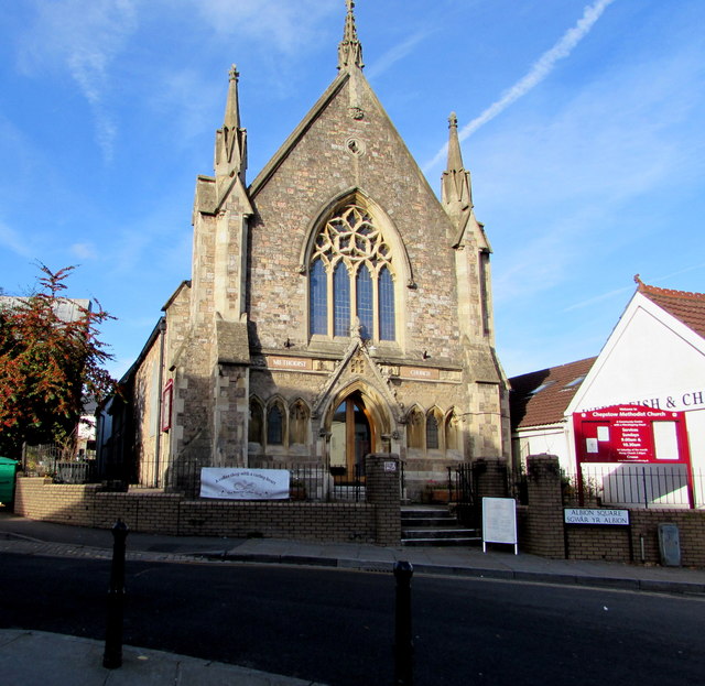
The building dates from the mid 19th century. The opening services were held on November 22nd 1855.
The building was Grade II listed in 1998.
Listed buildings and structures are officially designated as being of special architectural, historical or cultural significance. There are over half a million listed structures in the United Kingdom, covered by around 375,000 listings.
Listed status is more commonly associated with buildings or groups of buildings, however it can cover many other structures, including bridges, headstones, steps, ponds, monuments, walls, phone boxes, wrecks, parks, and heritage sites, and in more recent times a road crossing (Abbey Road) and graffiti art (Banksy 'Spy-booth') have been included.
In England and Wales there are three main listing designations;
Grade I (2.5%) - exceptional interest, sometimes considered to be internationally important.
Grade II* (5.5%) - particularly important buildings of more than special interest.
Grade II (92%) - nationally important and of special interest.
There are also locally listed structures (at the discretion of local authorities) using A, B and C designations.
In Scotland three classifications are also used but the criteria are different. There are around 47,500 Listed buildings.
Category A (8%)- generally equivalent to Grade I and II* in England and Wales
Category B (51%)- this appears generally to cover the ground of Grade II, recognising national importance.
Category C (41%)- buildings of local importance, probably with some overlap with English Grade II.
In Northern Ireland the criteria are similar to Scotland, but the classifications are:
Grade A (2.3%)
Grade B+ (4.7%)
Grade B (93%)
Read more at Wikipedia Link
 Map © Crown Copyright")
- Grid Square
- ST5393, 890 images (more nearby 🔍)
- Photographer
- Jaggery (more nearby)
- Date Taken
- Friday, 11 November, 2016 (more nearby)
- Submitted
- Thursday, 17 November, 2016
- Subject Location
-
OSGB36:
 ST 5321 9377 [10m precision]
WGS84: 51:38.4465N 2:40.6530W - Camera Location
-
OSGB36: ST 5323 9375
- View Direction
- Northwest (about 315 degrees)