2016
NY5615 : West Coast Main Line near Shap
taken 7 years ago, near to Shap, Cumbria, England
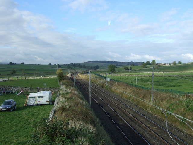
West Coast Main Line near Shap
Looking north west from the bridge on the A6.
West Coast Main Line
The West Coast Main line is a 399 mile long high speed railway from London Euston to Glasgow. The route has a long history dating back to the 1830s. The route today is one of the busiest in the country and serves the West Midlands, North West, North Wales and Southern Scotland.
A6 Road
The A6 is one of the main historic north south roads in England. At 299 miles long it is the fourth longest road in the country. It currently runs from Luton in Bedfordshire to Carlisle in Cumbria, although it formerly started at a junction with the A1 at Barnet.
Wikipedia: Link
See also Link
 Map © Crown Copyright")
TIP: Click the map for more Large scale mapping
- Grid Square
- NY5615, 110 images (more nearby 🔍)
- Photographer
- JThomas (more nearby)
- Date Taken
- Saturday, 22 October, 2016 (more nearby)
- Submitted
- Tuesday, 22 November, 2016
- Subject Location
-
OSGB36:
 NY 5608 1581 [10m precision]
WGS84: 54:32.1387N 2:40.8161W - Camera Location
-
OSGB36: NY 56169 15755
- View Direction
- Northwest (about 315 degrees)