2016
SO8687 : Circular Overflow, Staffordshire and Worcestershire Canal
taken 8 years ago, near to Kingswinford, Dudley, England
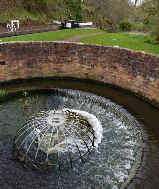
Circular Overflow, Staffordshire and Worcestershire Canal
This overflow is next to Rocky Lock No 15. These circular overflows were also referred to as "Brindley Lobster Pot Weirs".
Staffordshire and Worcestershire Canal
The Staffordshire and Worcestershire Canal was opened in 1772, engineered by James Brindley. It cost a little over £100,000 at the time. It links the River Severn at Stourport to the Trent and Mersey Canal at Great Haywood Junction in Staffordshire. There are 43 locks (45 if you don't fancy the deep wide locks at Stourport) and the canal is 46 miles in length.
 Map © Crown Copyright")
TIP: Click the map for more Large scale mapping
- Grid Square
- SO8687, 237 images (more nearby 🔍)
- Photographer
- Mat Fascione (more nearby)
- Date Taken
- Friday, 22 April, 2016 (more nearby)
- Submitted
- Sunday, 27 November, 2016
- Subject Location
-
OSGB36:
 SO 863 874 [100m precision]
WGS84: 52:29.1040N 2:12.1285W - Camera Location
-
OSGB36: SO 863 874
- View Direction
- South-southwest (about 202 degrees)