2016
SK7223 : The Sugar Loaf, Ab Kettleby
taken 7 years ago, near to Ab Kettleby, Leicestershire, England
This is 1 of 2 images, with title The Sugar Loaf, Ab Kettleby in this square
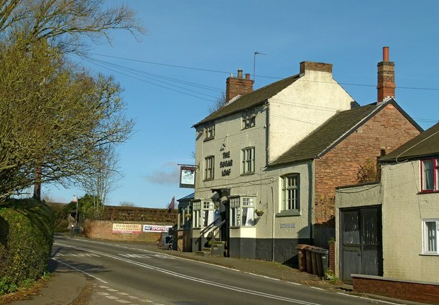
The Sugar Loaf, Ab Kettleby
Doubtless surviving as a result of passing trade along the main A607. Probably easier to get to by car than for villagers on foot, as the road is very tricky to cross at this point with very poor sight lines.
 Map © Crown Copyright")
TIP: Click the map for more Large scale mapping
- Grid Square
- SK7223, 66 images (more nearby 🔍)
- Photographer
- Alan Murray-Rust (more nearby)
- Date Taken
- Friday, 25 November, 2016 (more nearby)
- Submitted
- Tuesday, 29 November, 2016
- Subject Location
-
OSGB36:
 SK 7261 2315 [10m precision]
WGS84: 52:48.0619N 0:55.4671W - Camera Location
-
OSGB36: SK 7259 2312
- View Direction
- North-northeast (about 22 degrees)