2016

SK9770 : Lincoln transport hub

taken 7 years ago, near to Lincoln, Lincolnshire, England
This is 1 of 2 images, with title Lincoln transport hub in this square
Lincoln transport hub
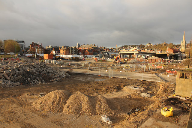
Major redevelopment work underway in Lincoln. The former bus station in the throes of demolition, seen from Pelham Bridge.
Pelham Bridge

On Friday 27th June 1958, the Queen visited Lincoln to officially open Pelham Bridge that broke new ground when it was the first bridge in the world mounted on rubber-steel laminated bearings. In 1955 the firm of consulting engineers, W.S. Atkins & Partners, contacted TARRC (then known as BRPRA) to consult on the technical possibility of designing rubber bearings large enough to use between the bridge deck and its supporting piers. This would enable the deck freedom of movement to take up expansion, contraction, coping with the heavy vehicles braking and accelerating, weaving traffic and the cross thrust of wind. The technology, which significantly cushions vibration, has since been used in more than 10,000 structures worldwide. Homes above underground stations and railways in London and buildings in earthquake zones all benefit from the innovation.

Lincoln Transport Hub

The Lincoln Transport Hub development scheme is a £30 million regeneration project expected to transform the city centre, linking a new bus station to the railway station, a 1,000 space multi-storey car park, retail space and a new pedestrian plaza.


Creative Commons Licence [Some Rights Reserved]   © Copyright Richard Croft and licensed for reuse under this Creative Commons Licence.
Geographical Context: City, Town centre Construction, Development other tags: Demolition Site Urban Redevelopment Click a tag, to view other nearby images.
This photo is linked from: Automatic Clusters: · Pelham [42] · Bus Station [17] Title Clusters: · Lincoln transport hub [2] ·
1:50,000 Modern Day Landranger(TM) Map © Crown Copyright
+
+
1:50,000 Modern Day Landranger(TM) Map © Crown Copyright
TIP: Click the map for more Large scale mapping
Grid Square
SK9770, 686 images   (more nearby 🔍)
Photographer
Richard Croft   (more nearby)
Date Taken
Sunday, 27 November, 2016   (more nearby)
Submitted
Wednesday, 30 November, 2016
Subject Location
OSGB36: geotagged! SK 9772 7099 [10m precision]
WGS84: 53:13.6185N 0:32.2596W
Camera Location
OSGB36: geotagged! SK 9778 7081
View Direction
North-northwest (about 337 degrees)
Clickable map
+
NW N NE
W Go E
SW S SE
Image Type (about): geograph 
This page has been viewed about 114 times
You are not logged in login | register