2016
SP2313 : Benchmark on tower buttress of St John the Evangelist
taken 7 years ago, near to Taynton, Oxfordshire, England
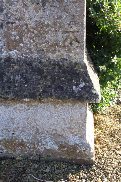
Benchmark on tower buttress of St John the Evangelist
Ordnance Survey cut mark benchmark described on the Bench Mark Database at Link
 Map © Crown Copyright")
TIP: Click the map for more Large scale mapping
- Grid Square
- SP2313, 40 images (more nearby 🔍)
- Photographer
- Roger Templeman (more nearby)
- Date Taken
- Thursday, 1 December, 2016 (more nearby)
- Submitted
- Friday, 2 December, 2016
- Subject Location
-
OSGB36:
 SP 2340 1353 [10m precision]
WGS84: 51:49.1946N 1:39.7150W - Camera Location
-
OSGB36: SP 2340 1353
- View Direction
- Southwest (about 225 degrees)