2016
SU4691 : St Michael and All Angels Church
taken 7 years ago, near to Steventon, Oxfordshire, England
This is 1 of 2 images, with title St Michael and All Angels Church in this square
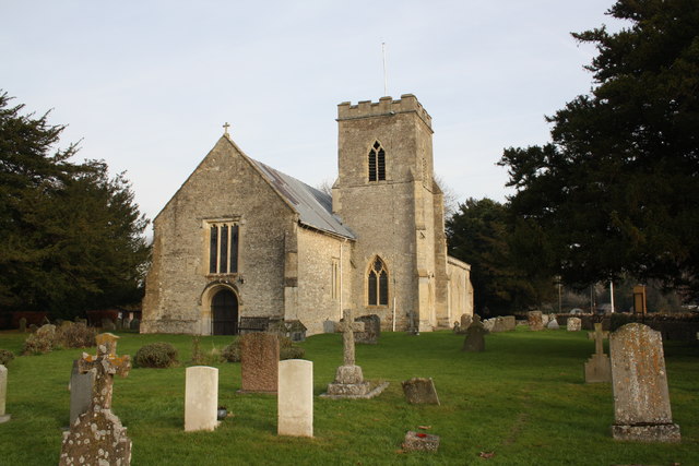
St Michael and All Angels Church
There is an OS benchmark SU4691 : Benchmark on St Michael & All Angels' Church at the left hand side of the doorway in the near face of the church
 Map © Crown Copyright")
TIP: Click the map for more Large scale mapping
- Grid Square
- SU4691, 186 images (more nearby 🔍)
- Photographer
- Roger Templeman (more nearby)
- Date Taken
- Monday, 5 December, 2016 (more nearby)
- Submitted
- Tuesday, 6 December, 2016
- Subject Location
-
OSGB36:
 SU 4643 9141 [10m precision]
WGS84: 51:37.1763N 1:19.8455W - Camera Location
-
OSGB36: SU 4641 9139
- View Direction
- Northeast (about 45 degrees)