2016
SO9044 : Large satellite dish
taken 7 years ago, near to Besford, Worcestershire, England
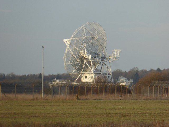
Large satellite dish
A large satellite dish on the site of the former RAF Defford. Passengers travelling by train between Birmingham and Cheltenham will have a good view of this as they pass by. Until 2005 this site was run by Qinetiq and fairly secretive. This large telescope is now part of MERLIN (Multi-Element Radio Linked Interferometer Network), an array of radio telescopes spread across England, plus Knockin in Ireland. They are run from the Jodrell Bank Observatory in Cheshire by the University of Manchester on behalf of Science and Technology Facilities Council (STFC).
 Map © Crown Copyright")
TIP: Click the map for more Large scale mapping
- Grid Square
- SO9044, 15 images (more nearby 🔍)
- Photographer
- Philip Halling (more nearby)
- Date Taken
- Wednesday, 7 December, 2016 (more nearby)
- Submitted
- Wednesday, 7 December, 2016
- Subject Location
-
OSGB36:
 SO 9029 4403 [10m precision]
WGS84: 52:5.6715N 2:8.5890W - Camera Location
-
OSGB36: SO 9057 4349
- View Direction
- North-northwest (about 337 degrees)