TR2849 : Eythorne Station
taken 8 years ago, near to Eythorne, Kent, England
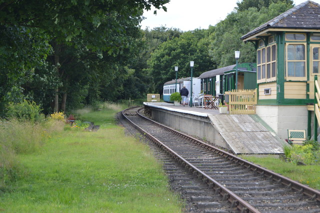
Eythorne station was a station on the East Kent Light Railway. It opened in 1916 and closed to passenger traffic in 1948. It was the junction for the branch to Guilford Colliery, which was abandoned in 1921. The track on this branch was lifted in 1931 but relaid during World War Two to accommodate a 9.2 inches rail mounted gun. The station served the village of Eythorne, it reopened as part of the East Kent Railway in 1993.
The East Kent Light Railway was part of the Colonel Stephens group of cheaply-built rural light railways in England. Holman Fred Stephens was engineer from its inception, subsequently becoming director and manager. The line ran from Shepherdswell to Wingham (Canterbury Road) Station with a branch from Eastry through Poison Cross to Richboro Port.
[Extract wikipedia Link]
Eythorne is a small village, 7 miles NNW of Dover. Although not classed as one of the former pit villages of Kent, it was only about a mile from Tilmanstone which closed in 1986.
Eythorne Baptist Church is more than 450 years old and one of the first Baptist churches in the UK.
The village is on the East Kent Railway.
Eythorne once had three pubs; The Crown is still trading, but the White Horse and the Palm Tree are long closed, both now being residential properties.
Eythorne is in historically set in two halves: Lower Eythorne, where the Church of England and Roman Catholic churches are situated, and Upper Eythorne, where the village shop and the Crown public house are located, and where most of today's villagers live. Many reside in the small housing developments that sprang up in the late 1960s and early 1970s.
 Map © Crown Copyright")
- Grid Square
- TR2849, 164 images (more nearby 🔍)
- Photographer
- N Chadwick (more nearby)
- Date Taken
- Saturday, 2 July, 2016 (more nearby)
- Submitted
- Thursday, 8 December, 2016
- Subject Location
-
OSGB36:
 TR 2813 4951 [10m precision]
WGS84: 51:11.9540N 1:15.8416E - Camera Location
-
OSGB36: TR 2815 4953
- View Direction
- Southwest (about 225 degrees)