2008
SO4382 : East on Corvedale Road - Craven Arms, Shropshire
taken 15 years ago, near to Craven Arms, Shropshire, England
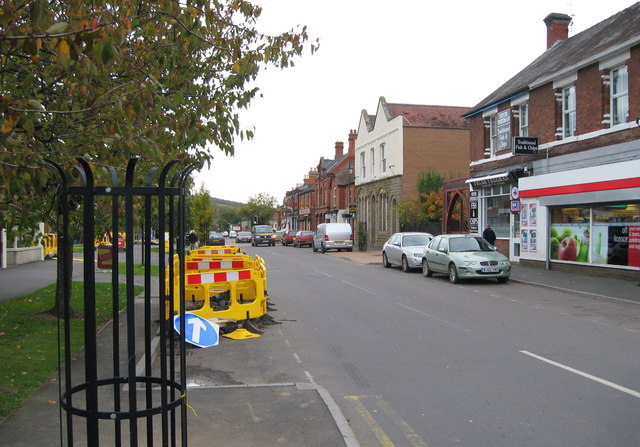
East on Corvedale Road - Craven Arms, Shropshire
Another view east along Corvedale Road, Craven Arms towards its junction with the A49 Ludlow - Shrewsbury Road. At one time I knew Craven Arms as just a couple of streets but how it has grown since those days. Originally the site of two hamlets, Newington and Newton, the town grew with the arrival of a railway junction in the 19th century and took its name from the 17th century Craven Arms Inn. The town has the headquarters of the Shropshire Hills AONB (Area of Outstanding Natural Beauty), the Secret Hills Discovery Centre, the Land of Lost Content museum - I found it a bit melancholic - and not far away to the south stands Stokesay Castle, an English Heritage property. Time taken 9.46 am BST (British Summer Time).
 Map © Crown Copyright")
TIP: Click the map for more Large scale mapping
- Grid Square
- SO4382, 354 images (more nearby 🔍)
- Photographer
- Martin Richard Phelan (more nearby)
- Date Taken
- Saturday, 25 October, 2008 (more nearby)
- Submitted
- Saturday, 10 December, 2016
- Subject Location
-
OSGB36:
 SO 43355 82805 [1m precision]
WGS84: 52:26.4158N 2:50.0838W - Camera Location
-
OSGB36: SO 43326 82805
- View Direction
- EAST (about 90 degrees)