2016
NT4628 : Long Philip Burn channel, Selkirk (2)
taken 7 years ago, near to Selkirk, Scottish Borders, Scotland
This is 1 of 2 images, with title starting with Long Philip Burn channel, Selkirk in this square
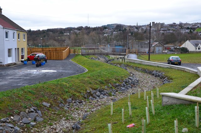
Long Philip Burn channel, Selkirk (2)
Looking towards the town from the A707 bridge, showing the course of the burn and the footbridge from which NT4628 : Long Philip Burn channel, Selkirk was taken.
Selkirk Flood Protection Scheme
An extensive civil engineering scheme is under construction 2015-2017 to mitigate flood damage from the Ettrick Water and the Long Philip Burn. Concrete walls are being built on the banks of the Ettrick to protect the low-lying parts of the town, along with ancillary works on footpaths and new footbridges. For more details, see the project website at Link
.
 Map © Crown Copyright")
TIP: Click the map for more Large scale mapping
- Grid Square
- NT4628, 239 images (more nearby 🔍)
- Photographer
- Jim Barton (more nearby)
- Date Taken
- Sunday, 11 December, 2016 (more nearby)
- Submitted
- Wednesday, 14 December, 2016
- Subject Location
-
OSGB36:
 NT 4610 2867 [10m precision]
WGS84: 55:32.9243N 2:51.3507W - Camera Location
-
OSGB36: NT 4604 2866
- View Direction
- EAST (about 90 degrees)