2016
NT5173 : Mill lade, Haddington
taken 7 years ago, near to Haddington, East Lothian, Scotland
This is 1 of 2 images, with title starting with Mill lade, Haddington in this square
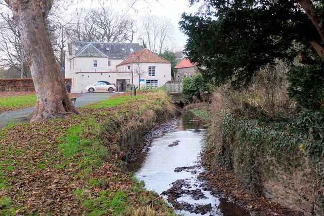
Mill lade, Haddington
The mill lade bringing water from the weir on the River Tyne with Poldrate Mill just in view.
 Map © Crown Copyright")
TIP: Click the map for more Large scale mapping
- Grid Square
- NT5173, 534 images (more nearby 🔍)
- Photographer
- Jim Barton (more nearby)
- Date Taken
- Sunday, 18 December, 2016 (more nearby)
- Submitted
- Wednesday, 21 December, 2016
- Subject Location
-
OSGB36:
 NT 5177 7345 [10m precision]
WGS84: 55:57.0988N 2:46.4348W - Camera Location
-
OSGB36: NT 5184 7347
- View Direction
- West-southwest (about 247 degrees)