2015
TQ4567 : Forest Way
taken 9 years ago, near to Petts Wood, Bromley, England
This is 1 of 3 images, with title Forest Way in this square
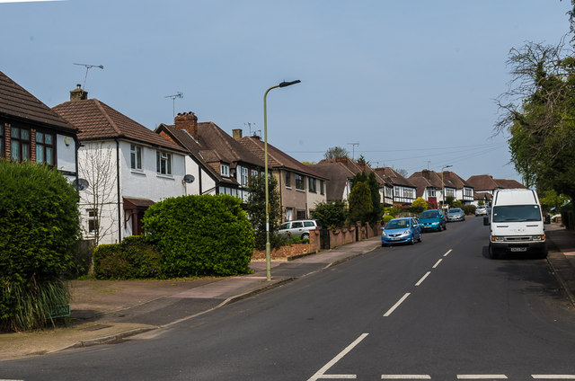
Forest Way
Mainly 1930s housing on the Robin Hood Estate, so called because most of the road names in the area have connections with Robin Hood, inspired by the name of an area of woodland called Robin Hood Shaw which was on part of the site.
 Map © Crown Copyright")
TIP: Click the map for more Large scale mapping
- Grid Square
- TQ4567, 91 images (more nearby 🔍)
- Photographer
- Ian Capper (more nearby)
- Date Taken
- Friday, 24 April, 2015 (more nearby)
- Submitted
- Thursday, 22 December, 2016
- Subject Location
-
OSGB36:
 TQ 459 675 [100m precision]
WGS84: 51:23.3120N 0:5.7838E - Camera Location
-
OSGB36: TQ 459 674
- View Direction
- NORTH (about 0 degrees)