2017
SZ1492 : Tuckton: footpath I23 heads downhill
taken 7 years ago, near to Southbourne, Bournemouth, Christchurch & Poole, England
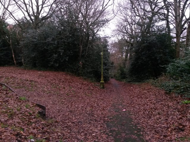
Tuckton: footpath I23 heads downhill
This public footpath comes from Northey Road (behind us) and is seen here heading across the edge of The Rookery, a wooded open space, on its way to Iford Lane.
See SZ1492 : Tuckton: footpath I23 approaches the railway embankment for the next view on the path ahead, and SZ1492 : Tuckton: footpath I23 crosses The Rookery Community Garden for the next view behind - each with links to further photos along the public footpath.
See SZ1492 : Tuckton: footpath I23 approaches the railway embankment for the next view on the path ahead, and SZ1492 : Tuckton: footpath I23 crosses The Rookery Community Garden for the next view behind - each with links to further photos along the public footpath.
Public rights of way in Bournemouth
A series of pictures documenting the public rights of way in the borough of Bournemouth. The pictures of the rights of way all have links to the next picture on the same route, in each direction.
The rights of way are all documented, in numerical order, in this article:
Link
![Creative Commons Licence [Some Rights Reserved]](https://s1.geograph.org.uk/img/somerights20.gif)


TIP: Click the map for more Large scale mapping
- Grid Square
- SZ1492, 169 images (more nearby 🔍)
- Photographer
- Chris Downer (more nearby)
- Date Taken
- Sunday, 8 January, 2017 (more nearby)
- Submitted
- Tuesday, 10 January, 2017
- Subject Location
-
OSGB36:
 SZ 1419 9290 [10m precision]
WGS84: 50:44.1326N 1:48.0172W - Camera Location
-
OSGB36: SZ 1419 9287
- View Direction
- North-northwest (about 337 degrees)


