2017
SE2217 : Trig pillar on Whitley reservoir embankment
taken 7 years ago, near to Whitley Lower, Kirklees, England
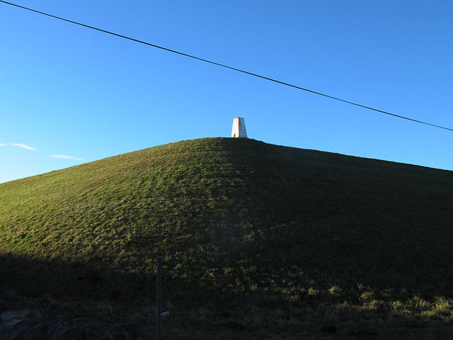
Trig pillar on Whitley reservoir embankment
Given the tendency of reservoir earth embankments to settle slowly over the years, this is a surprising location for a trig pillar, unless it is sat on a concealed concrete column.
I have been unable to find a date for construction of the reservoir, although it appeared on maps by the 1890s, and belonged to the Dewsbury and Heckmondwike Water Board.
I have been unable to find a date for construction of the reservoir, although it appeared on maps by the 1890s, and belonged to the Dewsbury and Heckmondwike Water Board.
 Map © Crown Copyright")
TIP: Click the map for more Large scale mapping
- Grid Square
- SE2217, 53 images (more nearby 🔍)
- Photographer
- Stephen Craven (more nearby)
- Date Taken
- Saturday, 14 January, 2017 (more nearby)
- Submitted
- Sunday, 22 January, 2017
- Subject Location
-
OSGB36:
 SE 2201 1778 [10m precision]
WGS84: 53:39.3633N 1:40.1068W - Camera Location
-
OSGB36: SE 2203 1778
- View Direction
- WEST (about 270 degrees)