2017
TR1634 : 67 - 69 High Street
taken 7 years ago, near to Hythe, Kent, England
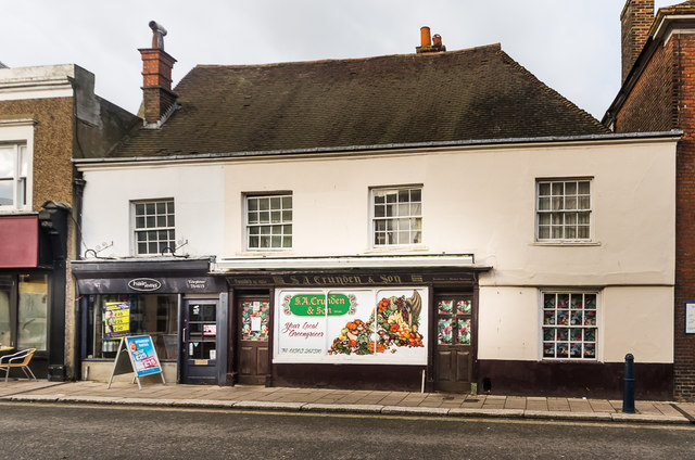
67 - 69 High Street
18th Century or older building on High Street. Grade II listed - see Link . The occupants of no 69 (the right hand section), the greengrocers S A Crunden, had been in Hythe since 1861 but the business closed around the end of 2016.
 Map © Crown Copyright")
TIP: Click the map for more Large scale mapping
- Grid Square
- TR1634, 540 images (more nearby 🔍)
- Photographer
- Ian Capper (more nearby)
- Date Taken
- Monday, 16 January, 2017 (more nearby)
- Submitted
- Sunday, 29 January, 2017
- Subject Location
-
OSGB36:
 TR 161 347 [100m precision]
WGS84: 51:4.2937N 1:5.0478E - Camera Location
-
OSGB36: TR 161 347
- View Direction
- North-northwest (about 337 degrees)