2017
SZ0890 : Bournemouth: footpath B03 and Avon House
taken 7 years ago, near to Westbourne, Bournemouth, Christchurch & Poole, England
This is 1 of 503 images, with title starting with Bournemouth in this square
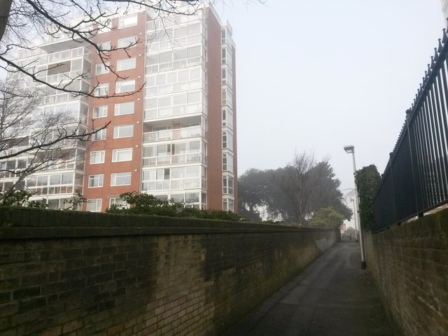
Bournemouth: footpath B03 and Avon House
Looking along this public footpath, connecting West Cliff Road with the West Cliff, on a foggy afternoon as it passes one of the desirable apartment on this western side of the town centre.
See SZ0890 : Bournemouth: sign for toilets on footpath B03 for the view towards us from along the path ahead, and SZ0890 : Bournemouth: footpath B03 to West Cliff Road for the view along the path from the end behind us.
See SZ0890 : Bournemouth: sign for toilets on footpath B03 for the view towards us from along the path ahead, and SZ0890 : Bournemouth: footpath B03 to West Cliff Road for the view along the path from the end behind us.
Public rights of way in Bournemouth
A series of pictures documenting the public rights of way in the borough of Bournemouth. The pictures of the rights of way all have links to the next picture on the same route, in each direction.
The rights of way are all documented, in numerical order, in this article:
Link
 Map © Crown Copyright")
TIP: Click the map for more Large scale mapping
- Grid Square
- SZ0890, 1540 images (more nearby 🔍)
- Photographer
- Chris Downer (more nearby)
- Date Taken
- Monday, 23 January, 2017 (more nearby)
- Submitted
- Sunday, 29 January, 2017
- Subject Location
-
OSGB36:
 SZ 0817 9072 [10m precision]
WGS84: 50:42.9632N 1:53.1384W - Camera Location
-
OSGB36: SZ 0818 9070
- View Direction
- North-northwest (about 337 degrees)