2017
SX0877 : Junction near Trevenning
taken 7 years ago, near to Michaelstow, Cornwall, England
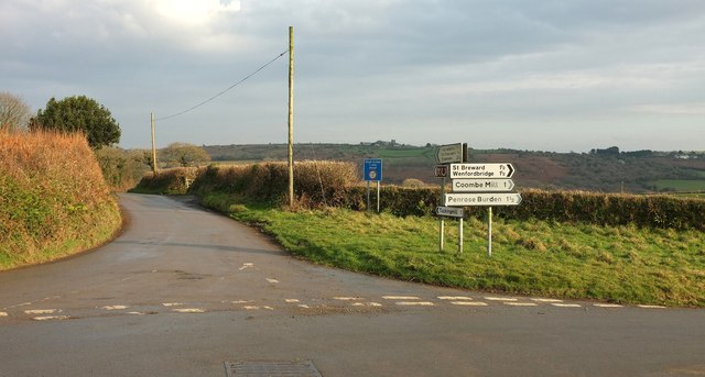
Junction near Trevenning
This was once a crossroads, but the B3266 has been given a more gentle curve as it performs a right-angled bend a few metres to the north, rendering this a T junction. Across the Camel valley in the background can be seen the northern, Churchtown, part of St Breward. The road ahead carries the parish boundary between St Tudy (right) and Michaelstow.
 Map © Crown Copyright")
TIP: Click the map for more Large scale mapping
- Grid Square
- SX0877, 19 images (more nearby 🔍)
- Photographer
- Derek Harper (more nearby)
- Date Taken
- Sunday, 22 January, 2017 (more nearby)
- Submitted
- Tuesday, 31 January, 2017
- Subject Location
-
OSGB36:
 SX 0817 7762 [10m precision]
WGS84: 50:34.0056N 4:42.6080W - Camera Location
-
OSGB36: SX 0816 7762
- View Direction
- EAST (about 90 degrees)