1978
SD9875 : Park Rash checkpoint, Fellsman Hike 1978
taken 46 years ago, 3 km from Kettlewell, North Yorkshire, England
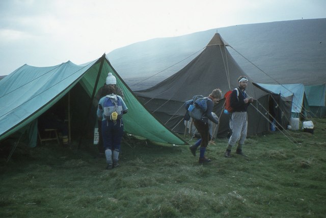
Park Rash checkpoint, Fellsman Hike 1978
Competitors checking in at Park Rash on the 61 mile event from Ingleton to Threshfield in Wharfedale.
Fellsman Hike :: SD6972
The Fellsman is a 61-mile route across the moors of the Yorkshire limestone country from Ingleton to Threshfield in Wharfedale. Competitors (walking or running) must visit 21 checkpoints, some of which have cut-off times, and refreshment is provided at feeding stations. The first event was held in 1962 and has continued annually apart from cancellation in 2001 due to the foot-and-mouth outbreak.
Detailed information can be found at the event website Link
 Map © Crown Copyright")
TIP: Click the map for more Large scale mapping
- Grid Square
- SD9875, 31 images (more nearby 🔍)
- Photographer
- Jim Barton (more nearby)
- Date Taken
- Sunday, 21 May, 1978 (more nearby)
- Submitted
- Tuesday, 31 January, 2017
- Subject Location
-
OSGB36:
 SD 986 756 [100m precision]
WGS84: 54:10.6142N 2:1.3400W - Camera Location
-
OSGB36: SD 986 756
- View Direction
- East-northeast (about 67 degrees)