2017
SP1821 : Green, Wyck Rissington
taken 7 years ago, near to Wyck Rissington, Gloucestershire, England
This is 1 of 2 images, with title Green, Wyck Rissington in this square
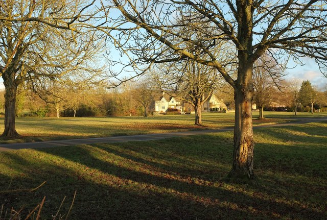
Green, Wyck Rissington
From the Oxfordshire Way and Diamond Way a few metres from where they meet the lane to Lower Slaughter. The village green, registered as common land, is about 6 acres in size; this looks across the western end. The two trails diverge at the green; the Diamond Way heads left, climbing to Icomb, while the Oxfordshire Way follows the green through the village. The two recross some kilometres away near Gawcombe.
 Map © Crown Copyright")
TIP: Click the map for more Large scale mapping
- Grid Square
- SP1821, 45 images (more nearby 🔍)
- Photographer
- Derek Harper (more nearby)
- Date Taken
- Saturday, 28 January, 2017 (more nearby)
- Submitted
- Friday, 3 February, 2017
- Subject Location
-
OSGB36:
 SP 1889 2184 [10m precision]
WGS84: 51:53.6876N 1:43.6137W - Camera Location
-
OSGB36: SP 1876 2186
- View Direction
- EAST (about 90 degrees)